MEM-LAS
Nevada, Arizona, Utah, Colorado, New MexicoAugust 3-12
- We packed up our tent and belongings at Toroweap and began the long journey back to normal roads. If we could make it...
 Driving out on the same bumpy, grinding road, the Mazda held up and got us back. After exiting at the entrance to the area, we still had another hour or so on the dirt desert road. We took a fork that led us west (since we were going to be heading west on the highway once we reached it). This road was less traveled, and certainly less maintained. Sand was up to a foot deep in some places, making it feel like we were driving through deep snow.
- Finally reaching AZ-389, we headed W/N and into Utah, going West toward I-15. We headed West on I-15 then took 12/169 South through Valley of Fire State Park in Nevada toward the Hoover Dam.
- We reached Hoover Dam and explored the dam and its museum a bit. Temps outside were well above 115 degrees. Very cool place though...it's a pretty incredible sight.
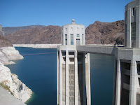
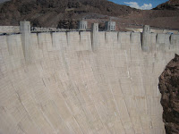
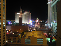
- After leaving Hoover Dam, we drove on to Las Vegas. We stayed at Harrah's on the strip. After eating dinner, we went to check out Bodies the Exhibition. Had some beers at a few different casinos, walked around, lost some money, then called it a night.
- The next morning (Aug 12), we packed up, drove to the airport, and headed back to Memphis.
MEM-LASNevada, Arizona, Utah, Colorado, New MexicoAugust 3-12- Departed camp at Kaibab National Forest around 8:30, dumped trash and got water at some RV park. We thought they might chase us, but we got out alive.
- Stopped in Fredonia for gas, beer, and breakfast. We then headed out to one of the most remote places either of us had been...Toroweap-Tuweep (be sure to click the link for information) is nearly 3 hours from any type of civilization. This is an area of the North Rim of the Grand Canyon, accessible only by a 2.5 hour drive on a very primitive dirt road.
 This place, managed by the BLM, is not for everyone. We passed the first 25 miles or so fairly easily. And then...when we arrived at the year-round ranger station, the ranger asked if we needed anything. As in, "what are you doing here?" And we told him that we were going to camp at Toroweap. His only reply was to chuckle and ask how we would get there, pointed at the car, and asked if that was what we came in. We said yes, and he said we wouldn't make it back out. To which we replied that it was a rental. Apparently that matters little. He essentially gave us the standard warning about recommending a SUV or 4WD (not something the little Mazda had). We decided to try it anyway - we had already taken the effort to get this far.
- Park brochure (.pdf)
- Then comes the hard part. More than an hour of bouncing on, over, and between a rocky "path" of a road. The car at some points would be leaning at such an angle it felt like it would tip over. We finally made it to the camping/overlook area and after the most stressful drive of our lives, we were pleased to have made it.

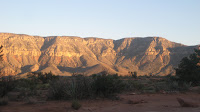
- The wind was incredible. The sustained winds were strong enough to blow anything away, including the tent. With stuff in it. Staked. The air being blown was so hot that we felt like we were in hell (temps were in the 115-120 F range). But the view and the idea of being in the middle of nowhere on the edge of the Grand Canyon was enough to make us not care.
 Draping clothing over any exposed skin, we went for a hike up to the actual rim of the canyon. It was breathtaking and dizzying at the same time (not the greatest combination of sensations when you're close to 4,000 feet [about 2/3 mile] up a sheer cliff). We took several pictures, climbed on rocks, found different vistas and watched rafters maneuver the Colorado River below...from up here they appeared to be just specks on the water.

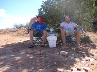
- After hiking back to the camp, we hung out in the shade of a scrub tree and watched jackrabbits and other small animals run around.
 We had a few beers and built a fire (not too successfully due to the winds).
- In the end, we were glad we braved the geology and remoteness of the place. It was getting back out in the morning that had us concerned.
MEM-LAS
Nevada, Arizona, Utah, Colorado, New MexicoAugust 3-12- Happy birthday, Nick's mom!
- We had gone to bed fairly early (~10) but still managed to sleep till about 9 am. We packed up and drove back to Jacob Lake Inn/Diner for breakfast. Interesting little place - nice, cute waitresses running all over the place. And although it is the middle of summer, there seemed to be a bit of a Christmas celebration going on. We knew this because of all the Christmas decorations - stockings, lights, the works. When we asked about it, the employees said that they celebrate Christmas in August because the place closes down for the winter and no one would be there.
- We had gained an hour (AZ does not observe DST). Drove to the North Rim of the Grand Canyon via AZ 67 - about 40 miles. Went to the visitor's center, then to the general store for ice (and a jacket). It has been really cold at night - upper 40s last night.
- We hiked the Ken Patrick Trail of the Canyon (click link and zoom in for a map), which takes you from the trailhead, 10 miles one way (...we did not follow the trail all 10 miles) along the Bright Angel Canyon drainages. The trail was very primitive and took some route finding abilities.
 We found out later that our difficulties were not through a lack of trying on our part - the trail is notorious for simply disappearing then continuing farther up ahead, up and down, in and out of drainages. It follows the rim for part, then through forest, then back on the rim...excellent views. We hiked for close to 3 hours along the Ken Patrick trail.
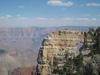
- After the hike, we drove farther into the park, to the end of the road at Cape Royal, where there were several incredible overlooks. The scenery is really amazing and the scale of the place just cannot be described or done justice in photos. This is truly one of the places that people have to see at least once in their lives.

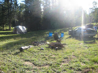
- When we left the park, we went back north into the national forest, a bit south of where we had camped the night before. Found a really nice site in the forest that was flat and had lots of wood around. It was COLD!!! In the lower 40s.
- Beer of the day: Trippel Belgian Ale (7.8%), Nimbus Pale Ale
- Dinner: corn on the cob, potatoes/onions, BBQ chicken
- Mileage 1350
- More North Rim info: http://www.bobspixels.com/kaibab.org/misc/gc_visit.htm#nr
MEM-LAS
Nevada, Arizona, Utah, Colorado, New MexicoAugust 3-12- We slept late at the hotel in Durango (till about 11...it was a rough night). Left the city around 12 or so. Among the souvenirs we picked up were 3 parking tickets.
- Ate lunch at Arby's in Farmington, NM, a town full of strip malls and shopping centers.
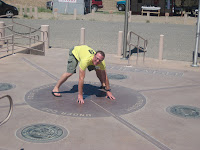
- Made our way to the Four Corners Monument, where the states of Utah, Arizona, Colorado, and New Mexico meet. This is a very remote area of the country, not surprisingly. No electricity, no water, no phones. It costs $3 to enter the monument area, which is managed by the Navajo Nation. Lots of Navajo selling jewelry at booths set up near the actual four corners. Took the typical tourist pictures then left. It is scorching hot here in the desert.
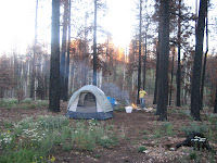
- Drove, then drove some more. A bit more driving, then we ended up in Page, AZ (a boating town on Lake Powell) and got some supplies. We decided to drive to Jacob Lake, but the campground there was closed. Ended up driving to Kaibab National Forest, which is about 25 miles north of the Grand Canyon's North Rim. We drove into the forest using a logging access road and went about a few miles in, where there was no one around - no campsites, no people - we just stopped driving and walked into the forest with a tent. It was eerily quiet. A recent fire had charred most of the trees in the forest, so we were very careful with our fire once we set up camp.
- Mileage 1227
MEM-LAS
Nevada, Arizona, Utah, Colorado, New MexicoAugust 3-12
- After a very windy night, Brad is awake at 8 or so, while Nick takes in more rest. Deer still lurk in and around the campsite.
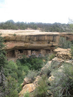
- We left Dalton Creek camp around 10 AM and drove into Colorado. Arrived at Mesa Verde National Park and checked out the cliff dwellings of the Anasazi people that lived in this area around 1200 A.D. Some of the dwellings have over 100 rooms. The rest of the park was also pretty cool - nice scenery, winding roads. Elevation in the park ranges from 6,000 - 8,500 feet.
- Continued on to Durango, CO. We had reserved a room at a very nice little boutique hotel called Nobody's Inn. It was a really cool place, above a store on a main street downtown. There were about 5 rooms, each with a clever name. The room we rented was called Anybody's Room. Cool antique items all over the place.
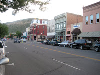
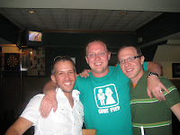
- The town of Durango reminds us of Missoula, MT (see 7/8/05) - cool bars, shops, a university. We ate at a place called Lady Falconburgh's (gross). The did have a great beer selection (38 on tap!). Walked around downtown then went to a bar/restaurant called The Quiet Lady. The bartender there (Aaron) was a bit of a know-it-all, but informative. Next we headed to a couple more alcohol-serving establishments, a few breweries (Caver's, then Steamhouse). All the beer was tasty. We ended up at a basement bar downtown near the hotel and drank some more. We met a couple from Austin named Joel and Margaret, who were very nice and liked to drink as well. Finally we ended up back at the room, where we made our way to the roof and hung out for a while before calling it a night. It was nice to sleep in a bed!
- Mileage 850

MEM-LASNevada, Arizona, Utah, Colorado, New MexicoAugust 3-12
- Departed camp around 8:30 (so early...) and drove to Arches National Park. Drove to Devil's Garden at the end of the road and took a 1.5 mile hike to Landscape Arch, which is the longest natural arch in the world at 290 feet.
 We saw a lot of other arch formations, but nowhere near the 2,000 that the park claims to have. It's possible that it's all a big hoax. We will get to the bottom of it, for sure.

- Drove to Moab, Utah and ate at a Mexican place (Nick had a burrito verde, Brad had a super burrito). Walked around Moab for a while - it's pretty touristy, but it's a nice place...and full of Native American crap for sale.
- We had a few pints at the Moab Brewery, then headed south 0n UT-191 to Monticello. Stopped at the visitor center there and talked to an old guy who told us to head to Dalton Creek Campground inside Manti-La Sal National Forest. So we did. And we were pleased. We got there around 3 PM and were the only campers there - the camping area had about 15 sites. It was really quiet, and there were a lot of deer...they felt the need to intrude on our campsite on more than one occasion, coming up to us within about 6 feet.
 Nick kept a table between himself and the deer but Brad was a hero and didn't run. Also lots of cows roaming the countryside.
- Elevation ~8,500 feet
- Dinner - BBQ chicken, sauteed zucchini/onions
- Beer of the day: assortment of the last 2 days, and PBR, Natty Light
- Mileage: 690
MEM-LAS
Nevada, Arizona, Utah, Colorado, New MexicoAugust 3-12
- Departed Hollow Flats around 10 AM. Went to Bryce Canyon National Park - more rocks! Lots of foreigners, checking out our natural landmarks and formations. Good to see people learning and enjoying our land. Short hike to Sunset/Sunrise points proved to be quite a cool experience - the views were amazing. Rock formations called Hoodoos covered the canyon - hoodoos are massive rock spires pop up from the ground like totem poles. Click on the link for more information.

- After leaving the park, we took US-89N to Richfield. Ate at a Pizza Hut because we wanted a salad bar. But read the rules if you do this - you do not want the waitress scolding you for visiting the salad bar twice. This is apparently against the rules.
- We took I70 east and after getting on the interstate, noticed a sign informing motorists of the lack of services for the next 100 miles or so. It was our belief that this sign should have been placed before the interstate. Because we ran out of gas. In the middle of the desert.
 Ended up pulling off the interstate and contacting UT highway patrol, who put us in contact with a service station (in Green River) east of where we were (Ghost Rock Lookout). Within 25 minutes or so, a truck from the station pulled up and provided us with our gasoline...for a steal at $200 (plus the cost of gas, of course).
- Getting back on the highway, we continued on I70, east to UT-191S, toward Arches National Park. Arriving near the park, we learn that the camp was full, which was not a big deal since we don't really care for NP camping anyway. We continued up the highway a bit farther to Oak Grove - a small patch of BLM land along the banks of the Colorado River.
 There was a burn ban, so we weren't allowed to have fires, but it wouldn't have mattered anyway - storms began rolling in, pouring rain and shooting lightning everywhere. We were in bed by 10 pm and it ended up raining all night.

- Beer of the Day: Golden Spike Hef, Bitch Creek Pale
- Dinner: sandwiches and chips
- Mileage: 560 total
MEM-LAS
Nevada, Arizona, Utah, Colorado, New MexicoAugust 3-12
- Departed hotel around 9 and hit a Wal-Mart for supplies ($102). Drove from Nellis to Hollow Flats (somewhere between Cedar Breaks and Long Valley Jct). On the way, we drove through Zion National Park.
 Very cool place - incredible sandstone formations and lots of wildlife - and it is easy to want to stay. Unfortunately, there were no fires allowed and campgrounds at the park were pretty full (of screaming children), and this was not a place we really wanted to be. So after touring the park for a while, we continued driving.

- Stopping at a house advertising firewood for sale, we met a retired gentleman who had quite a collection of animals - chickens, peacocks, billygoats...large ones. Large, smelly billgoats. (we know they smelled because he insisted we pet them.)
 He was quite a character, and full of information, which of course helped us - not that we needed to know how the irrigation laws in southern Utah worked, but he did give us some good camping location tips. He mentioned Dixie National Forest, accessible by taking US-89 to UT-14. We stopped at a visitor center and they directed us to a fairly secluded area (except for ATVs). It was a nice site - cooler here; elevation was about 6,000 feet.
- High temperature today was 107 degrees. Here in the forest it ended up around 75 degrees...nice to be out of the desert!
- Beer of the Day: Moab Brewery Scorpion Pale, Wasatch Apricot Hefeweissen, Wasatch Evolution Amber Ale
- Dinner: Turkey brats and corn
- Mileage: 230
MEM-LAS
Nevada, Arizona, Utah, Colorado, New MexicoAugust 3-12- Memphis to Las Vegas flight. Arrived at 9 PM and got the rental car.
 Drove to Super 8 Motel in Nellis, about 16 miles north of the city. Ate at the hotel restaurant - Blueberry Hill (the name alone should have been a clue) - a shitty, 24 hour family diner style eatery that served greasy chunks of food...but also beer (shitty beer). No redemption for that.


